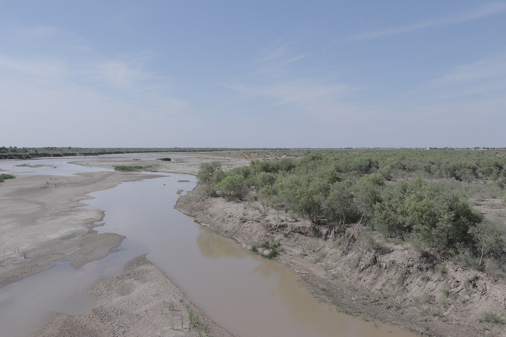
The Kyzylkum to the east, the Karakum to the south, the stone Ustyurt plateau to the west — and through the middle the Amu Darya, the ancient Oxus, fanning into a delta that once fed the Aral Sea.
Everything in Karakalpak history happens because of where the water goes.
- 166,590km²of land — about 37 % of Uzbekistan
- ≈ 2 millionpeople, 12 per square kilometre
- 50+ancient fortresses — the Elliq Qala
- 68,000km²the Aral Sea in 1960, fourth-largest lake on Earth
Chapter 1 · c. 7th century BCE – 4th century CE
Ancient Khorezm
Fifty fortresses guarded a river that has since walked away.
Keep scrolling — the fortress rises from the sand
Khwarazm — Chorasmia to the Greeks — enters written history as a satrapy of Darius I. In 480 BCE Chorasmian troops marched with Xerxes against Greece.
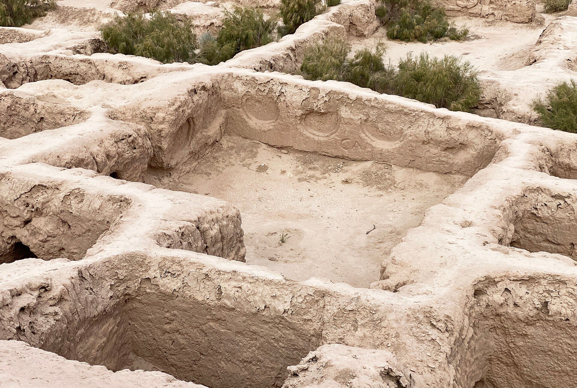
From about 500 BCE to 500 CE the delta was a densely irrigated, fortified farming civilisation: more than fifty mud-brick fortresses, the Elliq Qala.
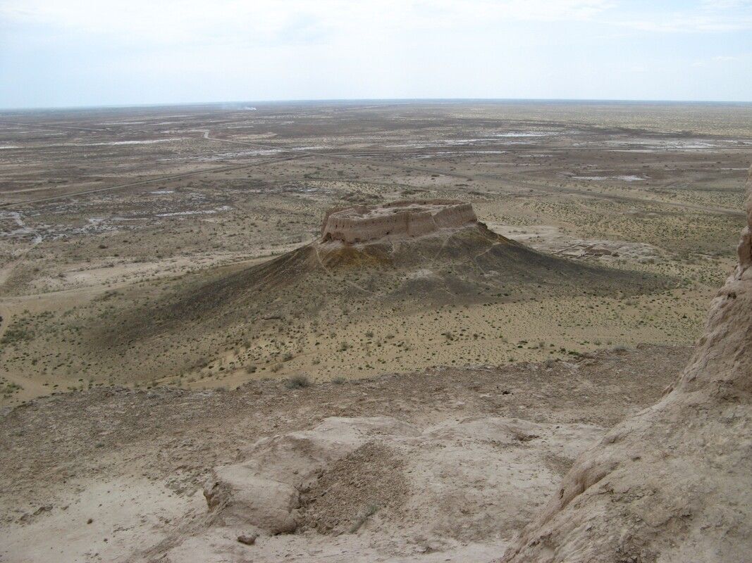
Ayaz-Kala 1
4th–3rd century BCE
182 by 152 metres on a 100-metre hill: double walls with a vaulted corridor, 45 towers, walls up to 10 metres high. Ayaz-Kala 3 (1st–2nd century CE) was a Kushan-era garrison of some 5 hectares; Ayaz-Kala 2 (6th–8th century) an Afrighid castle on a 40-metre cone with a 50-metre stair and a fire temple with wall paintings.
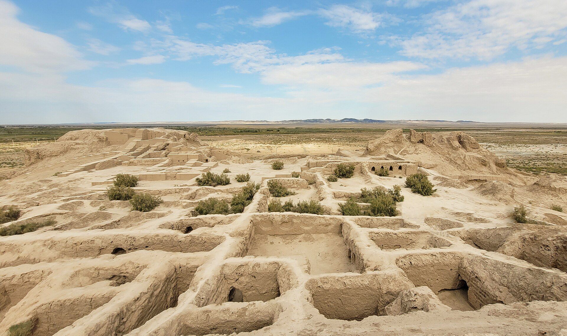
Toprak-Kala
1st–5th century CE
Capital of Chorasmia until the Afrighids moved to Kath after 305 CE. Its 2nd–3rd-century palace had painted halls, Hellenistic-Kushan high-relief sculpture and an archive of documents in the Khwarezmian language.
.wVYGWOcz_Z2xNPH.jpg)
User1712, CC BY-SA 4.0 Koy-Krylgan-Kala
4th–3rd century BCE
A circular temple-fortress with a Zoroastrian fire temple, destroyed around 200 BCE and resettled until about 400 CE. Among the finds: a man-shaped ossuary statue, now in the Hermitage.
Raf24~commonswiki, CC BY 4.0 Chilpik
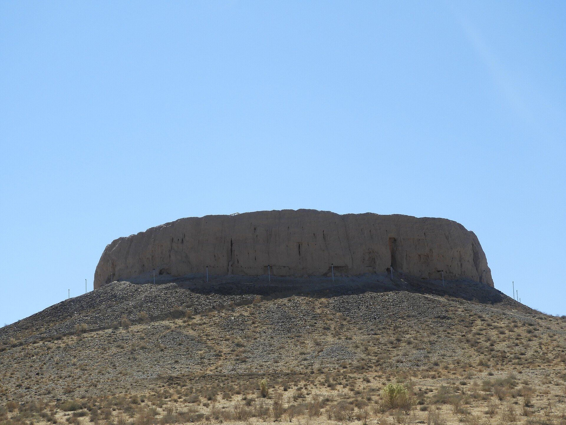
1st century BCE – 1st century CE
A Zoroastrian tower of silence about 15 metres high on a natural mound beside the Amu Darya, some 40 km from Nukus. Bodies were exposed to birds and sun; bones were kept in ossuaries. Used until the Arab conquest, later a signal tower. It stands on the state emblem.
_Fortified_Residence_1st-2nd_cent_CE_-_4th_cent_CE___restored_12th_cent_CE_(5).BrF3B54A_2dWRKn.jpg)
Bruce Allardice, CC BY-SA 2.0 Janbas-Kala and Kyzyl-Kala
Janbas-Kala: a Neolithic settlement and an Achaemenid-era fortress. Kyzyl-Kala, the Red Fortress: 1st–4th century, rebuilt in the 12th century and partly restored today.
The legend of Ayaz-Kala: a poor slave-hero, Ayaz, wins a princess and a fortress.
Chapter 2 · 7th – 13th century
Islam, scholars and Khwarazmshahs
Algebra was born beside this river.
The Afrighid dynasty ruled from Kath from 305 to 995. Islam arrived with the Arab conquest in the 8th century.
Al-Khwarizmi
c. 780–850
Born in Khwarazm. The words algorithm and algebra descend from his name and from his book.
Al-Biruni
973–1048
Born in Kath — today's Beruniy district is named for him. A polymath who measured the Earth's radius and wrote: “The people of Khwarezm were a branch from the Persian tree.”
The Ma'munid Academy
c. 1000
At Gurganj the Ma'munid Academy gathered Biruni and Ibn Sina.
The Khwarazmshahs
1077–1231
The Anushtegin Khwarazmshahs built an empire from Persia to the Syr Darya.

.jpg)

_Fortified_Residence_1st-2nd_cent_CE_-_4th_cent_CE_%26_restored_12th_cent_CE_(5).jpg)

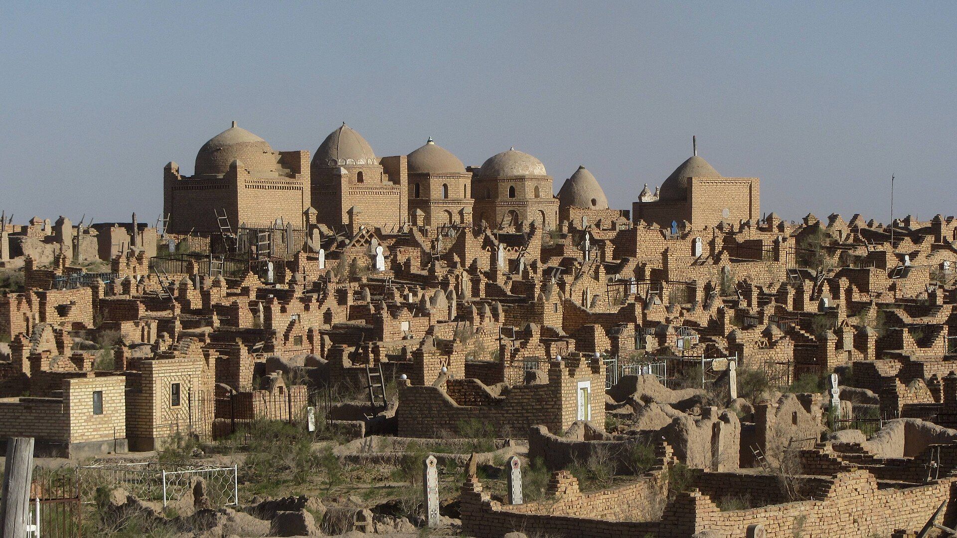
Mizdakhan, near Khojeyli, has been a burial ground since the 4th century BCE: 200 hectares, more than 2,000 graves, Zoroastrian ossuaries below and Islamic mausoleums above. Its name may come from Ahura Mazda. It flourished most in the 11th and 12th centuries.
1220–21: the Mongol invasion. Gurganj was destroyed when the Mongols breached the Amu Darya dams — “for every Mongol soldier, four inhabitants of Gurganj were killed.” The Sufi master Najmeddin Kubra died in the siege.
Chapter 3 · 14th – 18th century
From the Golden Horde to Khiva
A people named for a hat, born where two rivers argue.
Mizdakhan flourished again under the Golden Horde. Mazlumkhan-Sulu, from the first half of the 14th century, is a semi-underground portal-dome mausoleum with azure majolica and muqarnas. Shamun Nabi: seven domes over a 25-metre “grave” of a legendary magician.
1388: Timur razes Urganch as a rival to Samarkand. 1511: after the Amu Darya shifts its course, the Arabshahid Uzbeks found the Khanate of Khiva.
The people formed as a confederation in the late 15th and 16th centuries on the lower Syr Darya, near the Kazakh Lesser Horde — which is why language, dress and yurt are so close to Kazakh.
First written mention: 1583–1598, in decrees of Abdullah Khan II of Bukhara listing Karakalpaks near Sighnaq on the Syr Darya.
The 18th century was “the most difficult and tragic time”: Dzungar attacks and Kazakh pressure pushed the Karakalpaks down the Syr Darya and, during the 1700s, into the Amu Darya delta on the south shore of the Aral.
Jiyen Jıraw (1730–1784), the first named Karakalpak poet-bard, sang Posqan el — “The Ruined Nation” — the eyewitness lament of that flight.
Qırq Qız — Forty Girls
The Forty
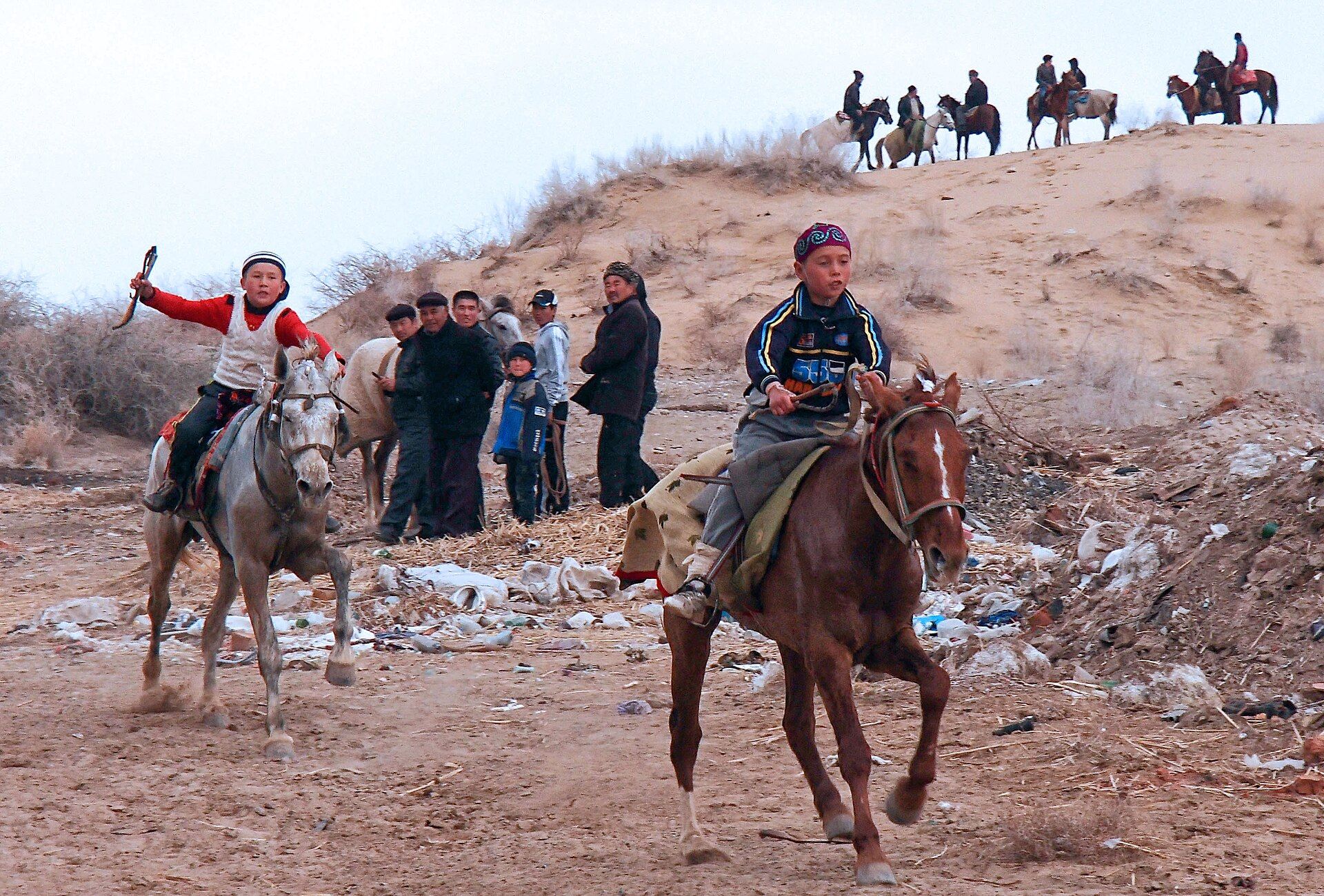
The national epic. Gulayım, the sixteen-year-old daughter of the ruler Allayar, receives the island of Miueli, builds a fortress and trains forty maiden warriors. When the Kalmyk khan Surtaysha sacks Sarkop and kills her father, Gulayım and the forty ride out, defeat the invaders and free the captives. The Khorezmian hero Arıslan first courts her, then fights beside her; they unite their lands “and build a society founded on peace and compassion.”
Written down in 1940 from the jyraw Qurbanbay Tájibaev; staged as a multimedia production by the Aga Khan Trust for Culture, directed by Saodat Ismailova, in 2018–19.
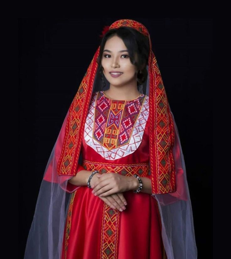
Karakalpak women's sauıt naǵıs — the “armour pattern” embroidery — is said to remember these warrior women.


Chapter 4 · 1810 – 1873
Under the Khan of Khiva
They had no army. They had poets.
From 1810 the Karakalpak fate was tied to Khiva: heavy taxes, forced canal labour, land seized by the khan's court.
- 1827
Uprising led by Aydos Bi — crushed, and later immortalised in Berdakh's poem Aydosbiy.
- 1855–56
Rebellion led by Ernazar Alakoz (c. 1806–1856), aiming at an independent Karakalpak khanate. Defeated; Ernazar killed. His mausoleum near Shimbay is a place of memory today.
- 1858–59
The Kungrad rebellion — the poet Ajiniyaz takes part and is exiled.
The poets
Kúnxoja
1799–1880
The elder folk poet who tutored Berdakh.
Ájiniyaz (Ziywar)
1824–1878
Born at Qamıs-buǵat near Muynak; studied in the madrasas of Khiva. His poem Bozataw laments the destruction of Bozatau. He taught poor children. His monument, with a dutar, stands beside the Savitsky Museum; his 200th anniversary was celebrated in 2024.
Berdaq
1827–1900
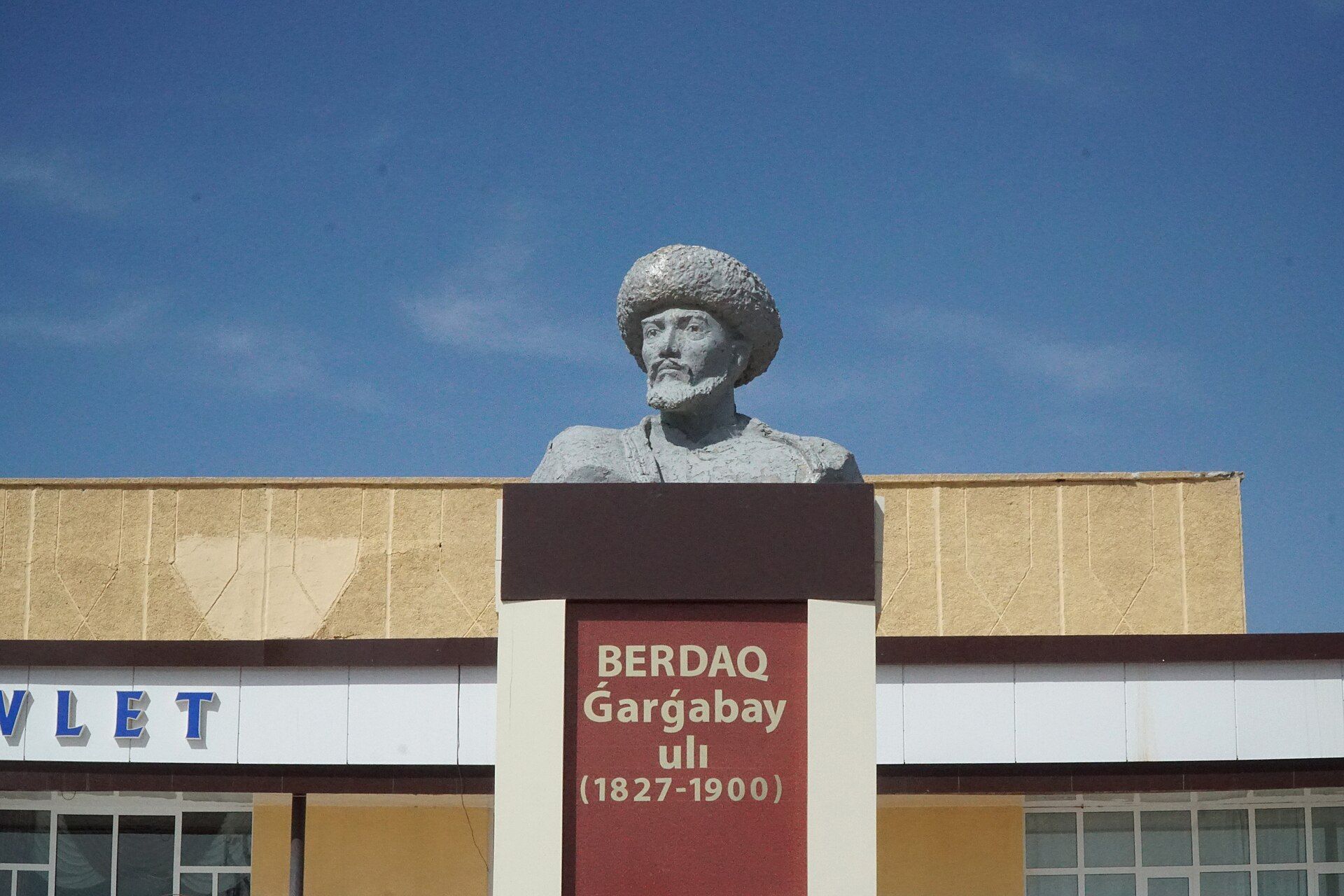
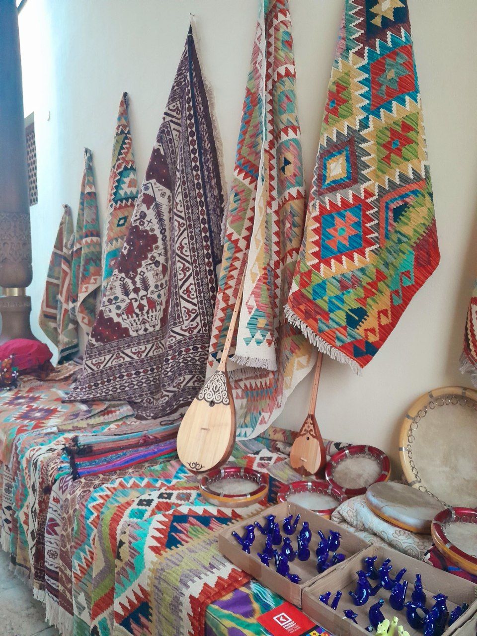
Berdimurat Gargabay ulı: born to a poor fisherman near Muynak, orphaned, self-taught, he sang his poems to the dutar at weddings — Shejire (Genealogy), Aqmaq patsha (The Foolish King), Xalıq ushın (For the People), Amangeldi, Aydosbiy, Ernazarbiy. The national poet: Nukus's university, theatre and a monument bear his name.


Chapter 5 · 1873 – 1936
Empire and Revolution
From the air, the desert gave up its cities.
- 1873
Khiva becomes a Russian protectorate. The right bank of the Amu Darya, with most Karakalpaks, is ceded to Russia as the Amu Darya Department.
- 1920
The Khiva Khanate is abolished; the Khorezm People's Soviet Republic follows (1920–24).
- 1924–25
Karakalpak Autonomous Oblast inside the Kazakh ASSR of the RSFSR.
- 1932
Karakalpak ASSR within the RSFSR. Nukus becomes the capital.
- 1936
5 December: transferred to the Uzbek SSR — the border that still exists.
- 1928 · 1940
Latin script in 1928; Cyrillic in 1940.
In 1937 Sergey Tolstov founded the Khorezm Archaeological-Ethnographic Expedition: 54 years, about 1,000 sites, 5,000 aerial photographs from 1946 on. Toprak-Kala, Koy-Krylgan-Kala and Janbas-Kala came to light. A young painter on the 1950 expedition was Igor Savitsky.
1946 — from the air
0 fortresses
Named points follow the brief; the rest are placed across the ancient delta to stand for the fifty.
Keep scrolling — the camera pulls back over the delta
Chapter 6 · 1936 – 1991
The Soviet century
One man hid a century of art in the driest place he could find.
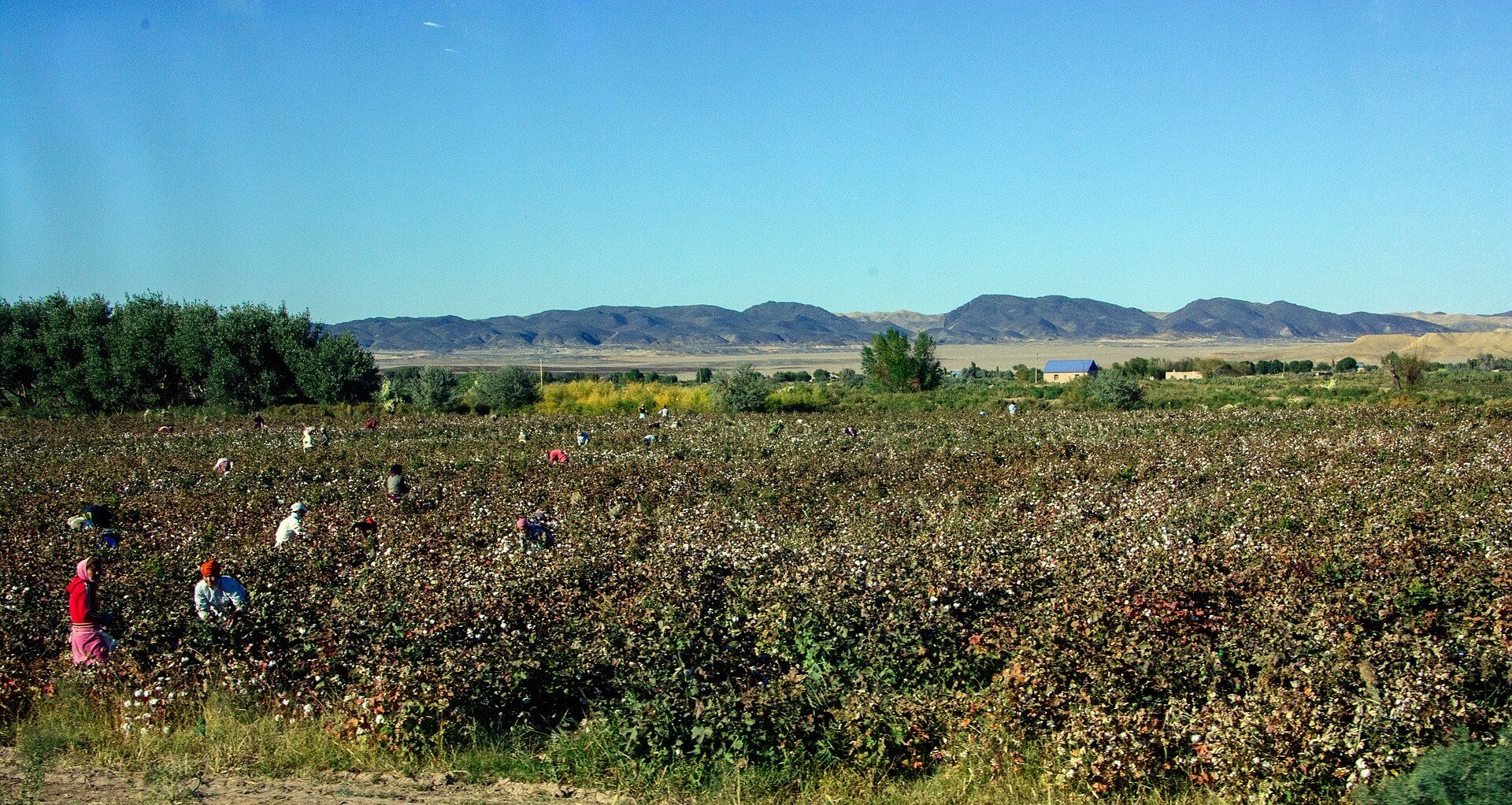
In the 1960s and 70s irrigation boomed and the region was “probably at its most prosperous”. Cotton and rice monoculture; the Muynak cannery employed some 30,000 people.
- 1⁄6of the entire Soviet fish catch came from the Aral
- 40,000fishermen
- 30,000workers at the Muynak cannery
- 500,000muskrat pelts a year from the delta reeds

.CHCGUiq3_Z1H2qj3.jpg)
.jpg)
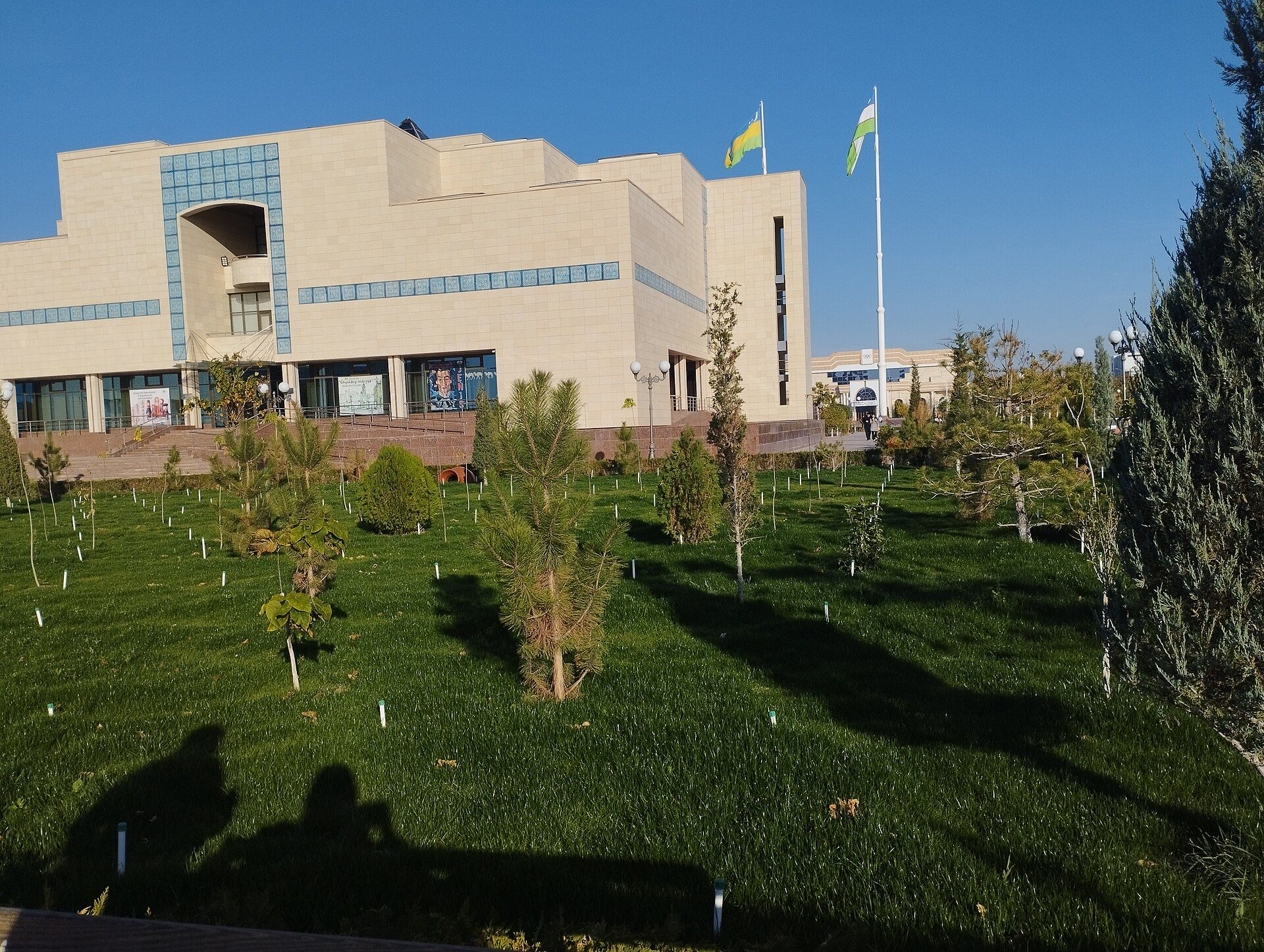
In 1966 Igor Savitsky (1915–1984) persuaded the authorities to found the Nukus State Museum of Art. He bought “state-approved” art on paper and forbidden avant-garde in fact — Volkov, Kurzin, Usto Mumin (Nikolaev), Tansykbaev, Lysenko — plus tens of thousands of Karakalpak jewellery, textiles and Khorezm antiquities. “The Louvre of the steppe.”
Keep scrolling — the canvases turn over
- Alexander Volkov
- Mikhail Kurzin
- Usto Mumin (Nikolaev)
- Ural Tansykbaev
- Vladimir LysenkoThe Bull — the museum's emblem
- 82,000+items in the collection
- ≈ 10,000avant-garde works — the second-largest Russian avant-garde collection in the world
Documentary: The Desert of Forbidden Art (Pope & Georgiev, 2010), with the voices of Ben Kingsley, Sally Field and Ed Asner.
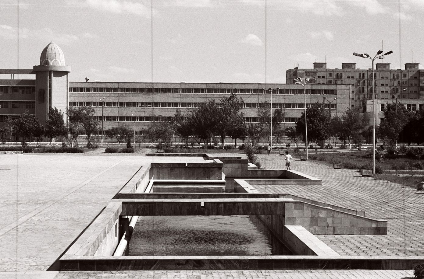

1948: a bioweapons test site on Vozrozhdeniya Island. In 1971 a smallpox leak infected 10 people and killed 3 in Aral city.
From 1960 the sea level fell 20 cm a year, then 50–60, then 80–90. In 1987 the Aral split into North and South.
Chapter 7 · 1960 – today
The sea that walked away
In 1960 you could not see the far shore. Today you cannot see the sea.
1960
68,000 km²
the fourth-largest lake on Earth
- 1960
- 1987
- 2004
- 2014
Keep scrolling — the sea shrinks
Salinity rose from 10 g/L to 376 g/L by 1990 — seawater is 35.
Commercial fishing was dead by 1987. Muynak's ships rust in the sand 30–90 km from the water — the Ship Graveyard.
.Bw3ZArzc_Z2oyHnL.jpg)
.jpg)
The exposed bed is a new desert, the Aralkum: salt-and-pesticide dust storms; anaemia and respiratory disease soared; in 2009 child mortality reached 75 per 1,000.
“One of the planet's worst environmental disasters.”
UN Secretary-General Ban Ki-moon, 2011
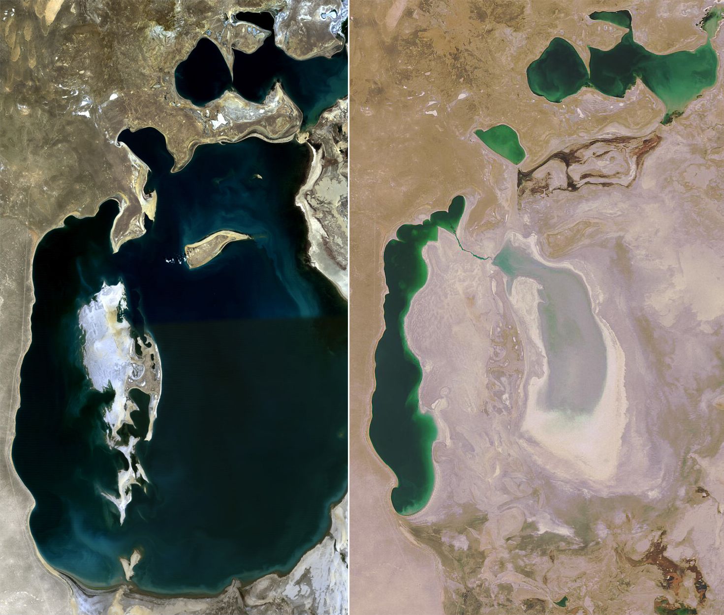
Kazakhstan's Kok-Aral dam (2005) revived the North Aral. Uzbekistan plants saxaul forests on the dry seabed. The Sudochye-Akpetki state reserve; the UN Multi-Partner Human Security Trust Fund for the Aral Sea region.
Stihia, since 2018: an electronic-music, art and science festival founded by Otabek Suleimanov beside the ship graveyard in Muynak — “not just a gigantic party… we do it in Muynak purposefully, because this is one of the most devastated parts of the country.”
Chapter 8 · 1990 – today
Sovereignty
Still here. Still singing.
- 14 Dec 1990
Declaration of state sovereignty of Karakalpakstan. 1991: Uzbekistan independent.
- 14 Dec 1992
The flag is adopted.
- 9 Apr 1993
Constitution and emblem adopted. The same year: an agreement to join Uzbekistan for 20 years as a sovereign republic, with the constitutional right to secede by referendum.
- 1994–2016
Karakalpak returns to the Latin script in 1994–96; the alphabet is refined in 2009 and 2016.
- 2003
A new Savitsky Museum building; another followed in the mid-2010s.
- 2023
The 2023 constitution preserved Karakalpakstan's sovereign status.
- 25 Feb 2023
Júweri gúrtik, the national dish, gets an annual festival day.
- Dec 2025
UNESCO inscribes the Karakalpak yurt and the kobyz and jyrau tradition on its intangible-heritage lists.
Keep scrolling — the stars come out

The flag
Three bands — blue, gold, green — separated by thin red and white lines. Blue is water, spring and sky; yellow the Karakalpak people and the desert; green fertility, renewal and Islam; white peace and harmony. In the blue band at the hoist: a white crescent and five stars.
The emblem
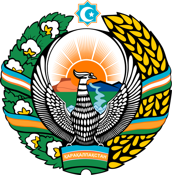
Adopted 9 April 1993, designed by Jollybai Izentaev: a rising sun over blue mountains, the Amu Darya and the Aral Sea, the Chilpik dakhma as the sign of ancient culture, and at the centre the mythical Xumay bird with open wings; a wreath of wheat and open cotton bolls tied with a ribbon; above, an octagon with crescent and star; below, the word QARAQALPAQSTAN.
The anthem
Adopted 24 December 1993 — lyrics by Ibrayım Yusupov, music by Najimaddin Muhammeddinov. It opens with a bayterek, a great tree of life growing on the bank of the Jayxun, the Amu Darya: one root, a thousand branches.

.geswR36x_cPIpk.jpg)
.jpg)
The map
Where it all happened
Thirteen places from this story. Positions are approximate, to about a kilometre.
- City
- Ancient site
- Nature
Nukus
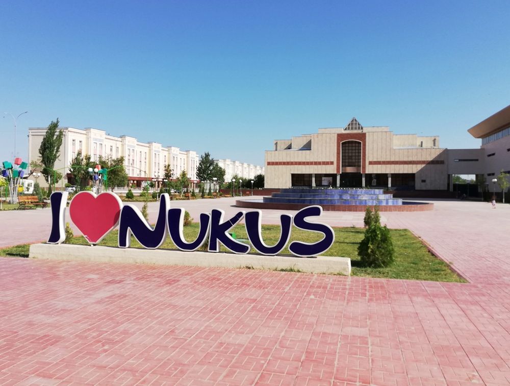
Capital; the Savitsky Museum, the Berdaq theatre and museum, the Ajiniyaz monument.
Mizdakhan & Gyaur-Kala
Necropolis and fortress, 15 km west of Nukus near Khojeyli.
Chilpik dakhma
Tower of silence on the Amu Darya, about 40 km south-east of Nukus.
Toprak-Kala
Painted palace of the Khorezm kings, Ellikqala district.
Ayaz-Kala 1–3
Hilltop fortresses and a yurt camp above a salt lake.
Kyzyl-Kala
Restored red fortress near Toprak-Kala.
Koy-Krylgan-Kala
Circular temple, Turtkul district.
Janbas-Kala
Neolithic and Achaemenid fortress at the desert edge.
Muynak
Ship graveyard, the Aral Sea museum, the Stihia site.
Sudochye lakes
Ramsar wetland: flamingos, pelicans, white-headed duck.
Ustyurt chinks
Stepped cliffs of 100–200 m at the plateau edge; the 14th-century Beleuli caravanserai.
Lower Amudarya Biosphere Reserve (Baday-Tugai)
Tugai forest with the world's largest Bukhara deer population, 1,600 and more.
Aral Sea, western shore
The “brilliant blue” remnant below the Ustyurt cliffs; a camping spot.
The people
Sixteen names
Scholars, rebels, poets, an archaeologist, a collector and the people who kept the collection.
Al-Khwarizmi
c. 780–850
Mathematician of Khwarazm; “algorithm”.
Al-Biruni
973–1048
Born in Kath; polymath.
Aydos Bi
d. 1827
Led the 1827 uprising against Khiva.
Ernazar Alakoz
c. 1806–1856
Led the 1855–56 rebellion for a Karakalpak khanate.
Kúnxoja
1799–1880
Folk poet, Berdakh's teacher.
Ájiniyaz (Ziywar)
1824–1878
Poet of Bozataw; taught poor children.
Berdaq (Berdakh)
1827–1900
National poet; Shejire, Aqmaq patsha.
Sergey Tolstov
1907–1976
Led the Khorezm expedition 1937–76.
Igor Savitsky
1915–1984
Founded the Nukus Museum of Art (1966).
Marinika Babanazarova
b. 1955
Museum director 1984–2015 who kept the collection intact.
Ibrayım Yusupov
1929–2008
People's Poet; wrote the anthem's lyrics; the play Forty Girls (1965); Hero of Uzbekistan 2004.
Tólepbergen Qayıpbergenov
1929–2010
Novelist: Daughter of Karakalpakstan, the trilogy Dastan about the Karakalpaks (USSR State Prize 1986); Hero of Uzbekistan 2003.
Jiyen Jıraw
1730–1784
First named Karakalpak bard; Posqan el.
Qurbanbay Tájibaev
20th century
Jyraw whose 1940 telling of Kyrk Kyz was written down.
Jollybai Izentaev
Artist who designed the state emblem (1993).
Otabek Suleimanov
Founder of the Stihia festival (2018).
Ána til — mother tongue
Thirty-two letters
Karakalpak is Kipchak-Nogai Turkic — closer to Kazakh than to Uzbek: vowel harmony, agglutinative, subject-object-verb. Between 412,000 and 870,000 speakers, depending on the count.
Latin alphabet, 2016 version
- A a
- Á á
- B b
- D d
- E e
- F f
- G g
- Ǵ ǵ
- H h
- X x
- I ı
- İ i
- J j
- K k
- Q q
- L l
- M m
- N n
- Ń ń
- O o
- Ó ó
- P p
- R r
- S s
- T t
- U u
- Ú ú
- V v
- W w
- Y y
- Z z
plus the digraphsSh shCh ch
Arabic script → Latin in 1928 → Cyrillic in 1940 → Latin again in 1994–95 → revised in 2009 → the 2016 alphabet.
Cyrillic, 40 letters
- А
- ә
- Б
- В
- Г
- Ғ
- Д
- Е
- Ё
- Ж
- З
- И
- Й
- К
- Қ
- Л
- М
- Н
- Ң
- О
- Ө
- П
- Р
- С
- Т
- У
- Ү
- Ў
- Ф
- Х
- Ҳ
- Ц
- Ч
- Ш
- Щ
- Ъ
- Ы
- Ь
- Э
- Ю
- Я
Forty riders, forty letters.
Words for the road
- Qaraqalpaqstan
- Karakalpakstan
- Xosh kelipsiz
- Welcome
- Assalawma áleykum
- Hello (formal)
- Watan
- Homeland
- Tariyx
- History
- Xalıq
- People
- Ána til
- Mother tongue
- Qara úy
- Yurt — “black house”
- Teńiz
- Sea — the Aral
- Dárya
- River
- Qala
- Fortress, city
- Jırlaw / dástan
- Epic song
- Rahmet
- Thank you
- Baslaw
- Start
- Dawam etiw
- Continue
Barlıq adamlar óz qádir-qımbatı jáne huqıqlarında erkin hám teń bolıp tuwıladı.Ǵǵ Áá Ńń Óó Úú Iı İi Shsh Chch — Қарақалпақстан
Ǵǵ Áá Ńń Óó Úú Iı İi Shsh Chch — Қарақалпақстан